Property Record
Spaulding Rd, , OH
Save to a Folder
{{folder.Name}}
{{folder.ListingIds.length}} Properties
{{folder.ListingIds.length}} Property
Create a New Folder
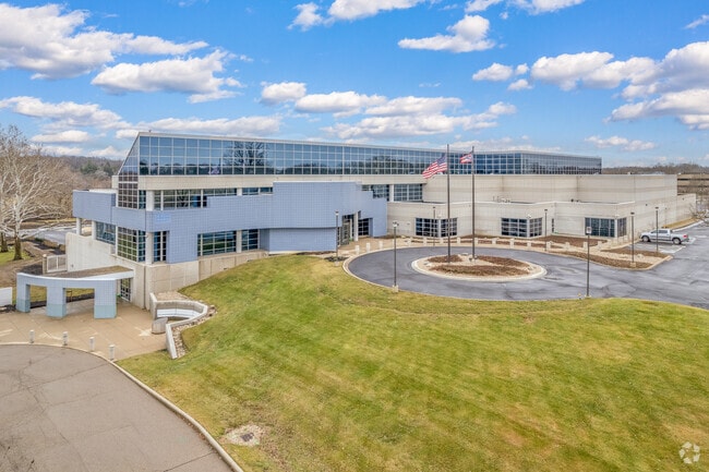
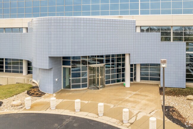
Property Detail
Spaulding Rd
Dayton, OH
7-2-13
N64-04529-0005
MONTGOMERY
Parkingstructure
Ohio
B and X Area of moderate flood hazard, usually the area between the limits of the 100-year and 500-year floods.
35
2024
2.64 AC
2025
South Central Dayton
021301
Cincinnati/Dayton
NEARBY LISTINGS FOR SALE OR LEASE
DEMOGRAPHICS near Spaulding Rd
1 mile
3 mile
5 mile
2025 Total Population
4,837
81,633
202,339
2030 Population
4,806
81,327
204,322
Pop Growth 2025-2030
(0.64%)
(0.37%)
+ 0.98%
Average Age
40
41
39
2025 Total Households
2,183
36,563
85,082
HH Growth 2025-2030
(0.46%)
(0.35%)
+ 0.95%
Median Household Inc
$68,314
$68,112
$71,027
Avg Household Size
2.20
2.20
2.20
2025 Avg HH Vehicles
2.00
2.00
2.00
Median Home Value
$169,835
$178,549
$220,775
Median Year Built
1957
1957
1960
Nearby Places
Map Layers
Map Styles
 Street
 Aerial
Layers
 Traffic
 Biking
Places
Listings with unknown addresses are not visible on the map
- Restaurants
- Banks
- Shops
- Fitness
- Groceries
PUBLIC TRANSPORTATION
AIRPORT
James M Cox Dayton International
Drive
Walk
Distance
James M Cox Dayton International
31 min
18.4 mi
Freight Ports
Port of Toledo
Drive
Walk
Distance
Port of Toledo
188 min
158.6 mi
SALE & LEASE HISTORY
LISTING DATE
SALE/LEASE

Dec 15, 2020
For Lease
Nearby Properties
Address
Land Use
TOTAL SIZE
Lot Size
Zoning
Address
Land Use
TOTAL SIZE
Lot Size
Zoning
414,094 SF
36.48 AC
Address
Land Use
TOTAL SIZE
Lot Size
Zoning
752,874 SF
74.85 AC
Address
Land Use
TOTAL SIZE
Lot Size
Zoning
240,090 SF
1.93 AC
MXPUD02
Address
Land Use
TOTAL SIZE
Lot Size
Zoning
175,938 SF
49.33 AC
Address
Land Use
TOTAL SIZE
Lot Size
Zoning
53.48 AC
RP1
Address
Land Use
TOTAL SIZE
Lot Size
Zoning
1,951 SF
56.54 AC
Address
Land Use
TOTAL SIZE
Lot Size
Zoning
130,247 SF
14.12 AC
Address
Land Use
TOTAL SIZE
Lot Size
Zoning
Address
Land Use
TOTAL SIZE
Lot Size
Zoning
41.38 AC
Address
Land Use
TOTAL SIZE
Lot Size
Zoning
38,832 SF
30.51 AC
R-PUD 03-7
Address
Land Use
TOTAL SIZE
Lot Size
Zoning
1,008 SF
7 AC
R1A
Address
Land Use
TOTAL SIZE
Lot Size
Zoning
4.98 AC
Address
Land Use
TOTAL SIZE
Lot Size
Zoning
109,680 SF
32.24 AC
R4
Address
Land Use
TOTAL SIZE
Lot Size
Zoning
100,450 SF
1.66 AC
MXPUD02
Address
Land Use
TOTAL SIZE
Lot Size
Zoning
148,309 SF
1.50 AC
MXPUD02
Address
Land Use
TOTAL SIZE
Lot Size
Zoning
152,844 SF
14.80 AC
Address
Land Use
TOTAL SIZE
Lot Size
Zoning
89,176 SF
17.52 AC
Address
Land Use
TOTAL SIZE
Lot Size
Zoning
54,604 SF
6.29 AC
MXPUD02
Address
Land Use
TOTAL SIZE
Lot Size
Zoning
309,331 SF
36 AC
Address
Land Use
TOTAL SIZE
Lot Size
Zoning
256,686 SF
11.05 AC
Address
Land Use
TOTAL SIZE
Lot Size
Zoning
23.20 AC
Address
Land Use
TOTAL SIZE
Lot Size
Zoning
20,144 SF
76.94 AC
A1
Address
Land Use
TOTAL SIZE
Lot Size
Zoning
7,694 SF
20.52 AC
MULTIPLE
Address
Land Use
TOTAL SIZE
Lot Size
Zoning
134,260 SF
11.75 AC
Address
Land Use
TOTAL SIZE
Lot Size
Zoning
205,801 SF
37.77 AC
Address
Land Use
TOTAL SIZE
Lot Size
Zoning
101,262 SF
10.83 AC
Address
Land Use
TOTAL SIZE
Lot Size
Zoning
20,832 SF
12.65 AC
Address
Land Use
TOTAL SIZE
Lot Size
Zoning
87,120 SF
5.80 AC
MXPUD02
Address
Land Use
TOTAL SIZE
Lot Size
Zoning
10.47 AC
Address
Land Use
TOTAL SIZE
Lot Size
Zoning
80,307 SF
1.05 AC
MXPUD02
The World's #1 Commercial Real Estate Marketplace
Connect with us
© 2026 CoStar Group
The information above has been obtained from sources believed reliable. While we do not doubt its accuracy we have not verified it and make no guarantee, warranty or representation about it. It is your responsibility to independently confirm its accuracy and completeness. Any projections, opinions, assumptions, or estimates used are for example only and do not represent the current or future performance of the property. The value of this transaction to you depends on tax and other factors which should be evaluated by your tax, financial, and legal advisors. You and your advisors should conduct a careful, independent investigation of the property to determine to your satisfaction the suitability of the property for your needs.